

Toll roads
As of today, there are 26 toll sections operating in the Republic of Kazakhstan with a total length of 4,883 km,
including: 12 sections of the 1st technical category with a length of 2,231 km, and 14 sections of the 2nd and 3rd
technical categories with a length of 2,652 km.
The first section, "Astana – Shchuchinsk," has been a toll road since 2013.
Since January 2019, the routes "Astana – Temirtau," "Almaty – Khorgos," and "Almaty – Konaev" have been operating
on a toll basis.
From November 23, 2021, the routes "Astana – Pavlodar," "Taraz – Kainar," "Shymkent – Kyzylorda," "Shymkent – Taraz,"
"Shymkent – Uzbekistan border," "Konaev – Taldykorgan," and "Shchuchinsk – Kokshetau" became toll roads.
In 2023, between October 8 and December 1, six additional toll road sections were opened in stages: "Pavlodar –
Kalbatau," "Beineu – Akzhigit," "Uralsk – Russia border (Samara)," "Pavlodar – Russia border (Omsk),"
"Kokshetau – Petropavlovsk," and "Uralsk – Russia border (Saratov)."
In 2025, the following sections commenced toll operations: "Kyzylorda – Aral," "Kostanay – Russia border (Troitsk),"
"Aktobe – Russia border (Orenburg)," "Kostanay – Denisovka," "Taraz bypass," "Balkhash – Burylbaytal," "Shu –
Burylbaytal," "Kandyagash – Makat," and "Usharal – Dostyk."
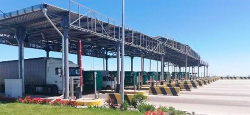
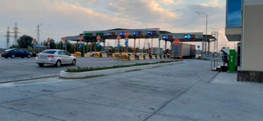
Toll sections of roads
Main characteristics of toll sections and toll rates
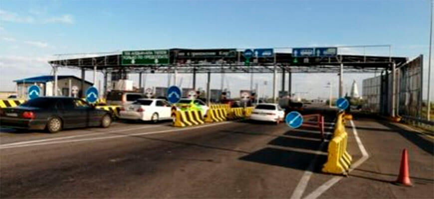
Section Astana - Shchuchinsk
Length – 211 km
Road category - I-a
Traffic lanes – 6 lanes in both directions
Payment lanes – 12 lanes
Toll booth - 2
Control arches – 4
System type – hybrid
Weather stations – 4
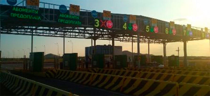
Section Astana - Temirtau
Length – 134 km
Road category - I-a
Traffic lanes – 4 lanes in both directions
Payment lanes – 16 lanes
Toll booth - 2
Control arches – 5
System type – hybrid
Weather stations – 6
Section Almaty - Konaev
Length – 42 km
Road category - I-a
Traffic lanes – 6 lanes in both directions
Payment lanes – 12 lanes
Toll booth - 1
Control arches – 1
System type – hybrid
Weather stations – 2
Section Almaty - Khorgos
Length – 295 km
Road category - I-b
Traffic lanes – 4 lanes in both directions
Payment lanes – 16 lanes
Toll booth - 2
Control arches – 6
System type – hybrid
Weather stations – 6

Section Konaev - Taldykorgan
Length – 186 km
Road category - I-a, I-b
Control arches – 4
System type – open
Section Astana - Pavlodar
Length – 375 km
Road category - I
Control Arches – 7
System type – open
Section Balkhash – Burylbaytal
Length – 91 km
Road category - I-b
System type – open
Section Shu – Burylbaytal
Length – 175 km 800 m
Road category - II
System type – open
Pavlodar - Semey - Kalbatau section
Length – 456,2 km
Road category - I-b, II
System type – open
Aktobe - Russian Federation (to Orenburg)
Length – 82,692 km
Road category - ІІ
System type – open
Kostanay - Russian Federation (to Troitsk)
Length – 163 km
Road category - ІІ
System type – open
Uralsk - border of the Russian Federation (to Samara)
Length – 56 km
Road category - III
System type – open
Pavlodar - border of the Russian Federation (to Omsk)
Length – 198,5 km
Road category - I-b, II
System type – open
Kokshetau – Petropavlovsk
Length – 169 km
Road category - I-b, II
System type – open
Section Shymkent - Kyzylorda
Length – 425.5 km
Road category - I-b
Control arches – 9
System type – open
Section Kyzylorda - Aral
Length – 454,85 km
Road category - II
Control arches – 6
System type – open
Shymkent - Taraz section
Length – 89.3 km
Road category - I-b
Control arches – 5
System type – open
Plot Shymkent - Uzbekistan
Length – 84 km
Road category - I-b
Control arches – 3
System type – open
Section Shchuchinsk - Kokshetau
Length – 60.75 km
Road category - I-b
System type – open